

Survey drawings form the backbone of any design work, making accuracy an absolute necessity. Mistakes could result in rejection by the planning department and costly redesign efforts. Full Measured Building Surveys in London provide accurate information that empowers individuals to make sound decisions, making them an indispensable component of any construction or renovation project.
Accuracy
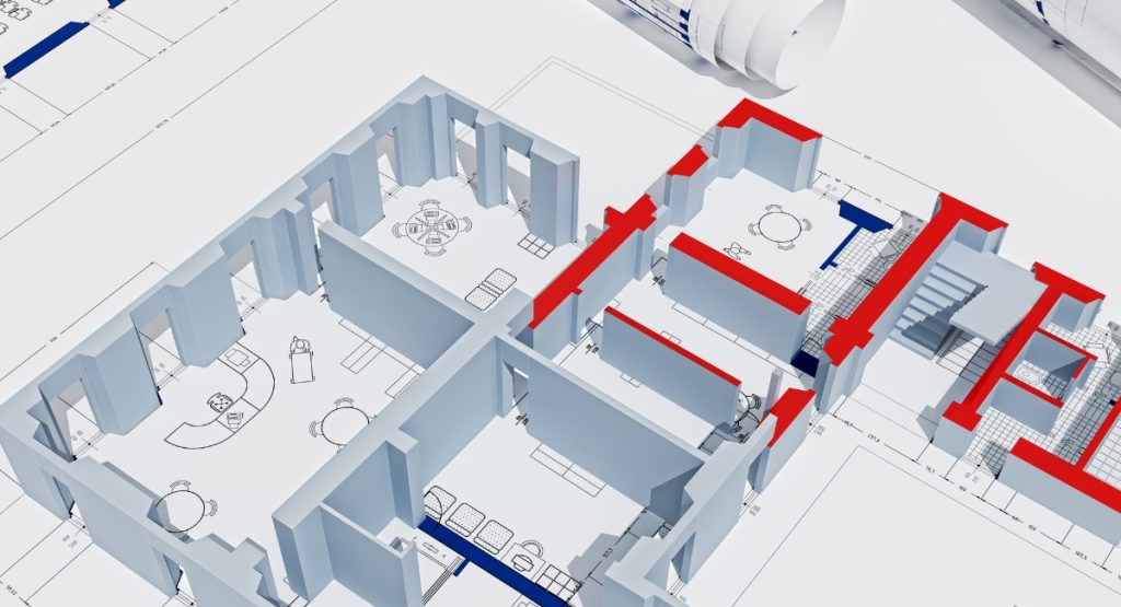
A fully measured survey allows architects and building specialists to capture accurate information about an existing structure, which can then be utilized for various purposes ranging from renovations and refurbishments to space planning. With accurate drawings at their fingertips, buyers and investors can make more informed purchasing decisions, while developers or builders can complete work more easily.
Navigating London's complex architectural terrain requires a tailored approach to measured surveys, and our team is are expert at this. From updating existing plans to producing as-built drawings for new properties, we provide solutions tailored to your exact requirements.
Our surveyors utilize industry-leading Faro 3D Laser Scanning Equipment for fast and accurate data collection without human error, so your drawings will be complete and correct from day one.
Homeowners, landlords and property developers across London rely on our measured survey services for purchase decisions as well as to ensure construction projects are completed on time and within budget. Furthermore, accurate drawings allow our clients to comply with building regulations while also preventing costly disputes over planning permissions or post-build issues arising later. In turn, the rapid nature of our surveys allows us to produce reports with as-built CAD drawings quickly - our clients rely on us for timely completions!
Time
An accurate measured survey is the keystone of a successful building project. It provides a complete and detailed dataset on any structure or land area and forms the basis for creating precise blueprints and 3D laser scan models; architects and property developers often rely on this survey data when planning extensions or renovation projects that blend seamlessly into the existing building fabric while adhering to planning regulations.
Accurate information can quickly lead to time delays, higher labor and material costs, and unexpected obstacles during construction projects. Therefore, it is worthwhile to invest in professionally measured surveys early on.
Topographical surveys provide essential data that can aid governments, organizations, businesses and private individuals to respond more quickly and effectively to natural disasters such as natural calamities, famines, floods or any other crisis. By identifying areas prone to disasters, topographical surveys can also be used to develop risk assessment models, evacuation plans and infrastructure resilience measures that protect communities as well as the environment.
Topographical surveys play an invaluable role for government agencies when it comes to land management and development. Topographical surveys can identify areas prone to soil erosion, landslides and floods so appropriate precautionary measures can be taken - providing vital information that ensures the safety and security of buildings, roads and infrastructure.
Safety
Measured building surveys London provide architects and engineers with an in-depth understanding of a structure's existing conditions. This enables them to develop detailed plans that precisely reflect conditions on-site while meeting safety regulations. Construction teams also gain from this knowledge, as it helps allocate resources more efficiently, cutting wasteful expenditures while preventing cost overruns.
Surveyors are trained professionals who can detect issues that pose risks to occupants, such as structural movement due to subsidence or settlement or noncompliance with fire safety regulations. Though surveyors can only assess properties according to their qualifications, they can still flag issues that require further investigation—perhaps by hiring an engineer.
Topographical surveys are an integral component of urban development and land management in the UK, providing accurate data that informs informed decision-making and sustainable practices. Such data helps mitigate natural disasters such as floods and landslides while simultaneously helping prepare emergency mitigation measures and implement emergency plans. Topographical surveys also ensure compliance with regulatory frameworks and potential legal disputes or liabilities that might arise as a result.
Knowledge
Architects, designers, and builders need the appropriate tools to complete projects on time and within budget. A fully measured building survey provides invaluable knowledge and skills.
This type of survey creates a detailed map of an existing structure, detailing dimensions and architectural features. It can be used as evidence for planning applications as well as renovation, refurbishment or extension work.
Metric surveys are crucial at the pre-planning stage to reducing the risks associated with costly errors like overreach or failing to adhere to planning conditions. With our Faro 3D laser scanning equipment and experienced surveyors on hand, measured surveys can reduce site times while increasing accuracy and producing more precise data.
Information gathered through a measured survey can then be used to create accurate As-built CAD building floor plans, elevations, and section drawings. This is especially helpful for architects and designers who aim to create detailed proposals while ensuring their designs are implemented as planned.